Stone walls and Boundary Lines. Ownership and Family History
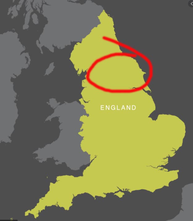
Throughstone and Richmondshire. 2 words I learnt as I roller-coasted through the northern counties of Yorkshire, Cumbria and Northumberland. 2 words I didn’t know as the van heaved up one incline and down the next. I was in upland country; sheep country where the world seemed to be harsher than my ‘Chalk and Cheese’ of down south.

A land of history told, in part, through its fields, walls and outbuildings.
Richmondshire was once one of the largest self-governing domains in England, occupying a large slice of the North, spreading across terrain that is now known as Yorkshire and Northumberland. Today Richmondshire is an administrative region and not an English county despite the confusion of ‘shire’ sitting in its name.
Recorded in the 1086 Domesday book, the city of Richmond and the wider region are clearly marked as being ‘wealthy and prized lands’. Perhaps that alone was enough to put it on a course for a turbulent history which has become folklore.
‘The Honour of Richmond was one of the three largest lordships created by William the Conqueror. King William granted it to his double-second-cousin, Alan the Red, the leader of the Bretons in England and a cousin of Hawise, Duchess of Brittany.’ Thanks Wiki.
Someone called ‘Erik Bloodaxe’ is also mentioned. Erik was an 11th century overlord with powers that would probably exceed those of today’s most zealous Councillor. However, I made the remarkable [to me] discovery that the 2 below are Richmond’s most recent MPs. Reasonably heavyweight even if their axemanship might need brushing up.
Dent and the Dales are unashamedly BLUE.

This year’s trip was going to be different – it was September; Coronavirus was still running its course and it was evident the Camping and Caravanning world had never really got out of the flat spin caused by earlier site closures across the country.
Finding places to stay on what would have been a routine ramble proved difficult and in some locations impossible…
Below: Stopping at the reliable ‘High Laning’ site in Dent. A small picture-postcard village only 20 mins from Kendal, just in the Yorkshire Dales National Park.

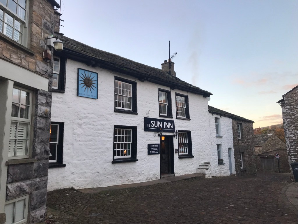
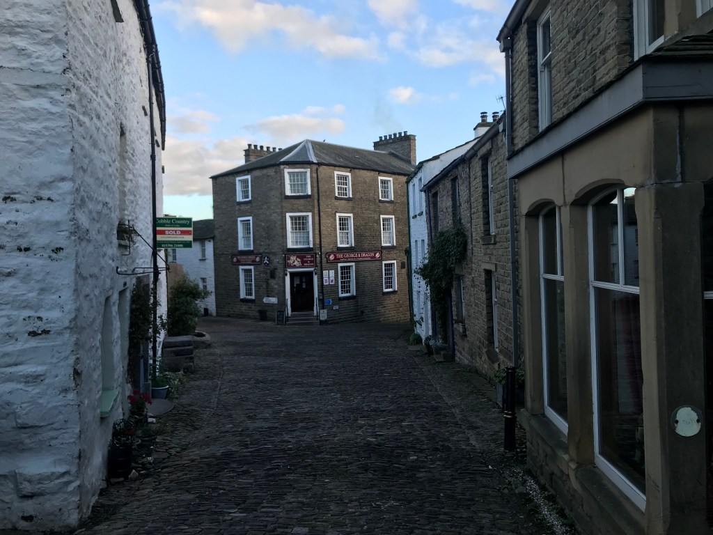
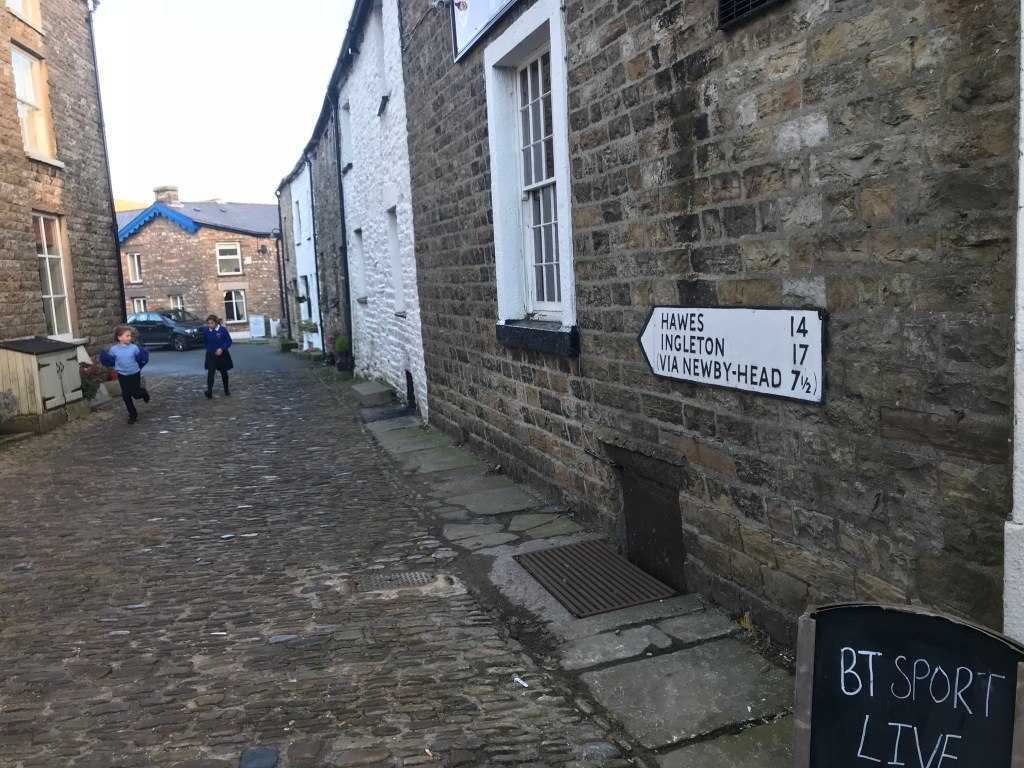
Visitors to Dent – and there are many; must be taken by the cobbled charm, the Norman church and the two pubs selling Dent Dale Ales. The pubs are just what you’d expect – despite Sky Sports in both. Our arrival in ‘The George and Dragon’ was greeted by a sudden silence – but maybe that was just in the imagination; a bi-product of watching films with similar scenarios. Unfortunately drinking in a public house has become a masked affair and customers are ushered to a table to await ‘service’. No hanging around at the bar. To my mind American-style waitress service doesn’t quite work in a ‘Last of the Summer Wine’ pub with a gauche teenage boy talking to you from behind a screen of perspex.

The Dent Brewery
A small independent business trying to make a mark with its ‘award winning’ beers in times of Covid.
The effects of the pandemic on local pubs and enterprises like the Dent Brewery is going to become all too evident. At the time of writing the seasonal rush may be at an end – but already there’s talk of a general ‘No Go!’ ruling on tourist activity in the first part of 2021.
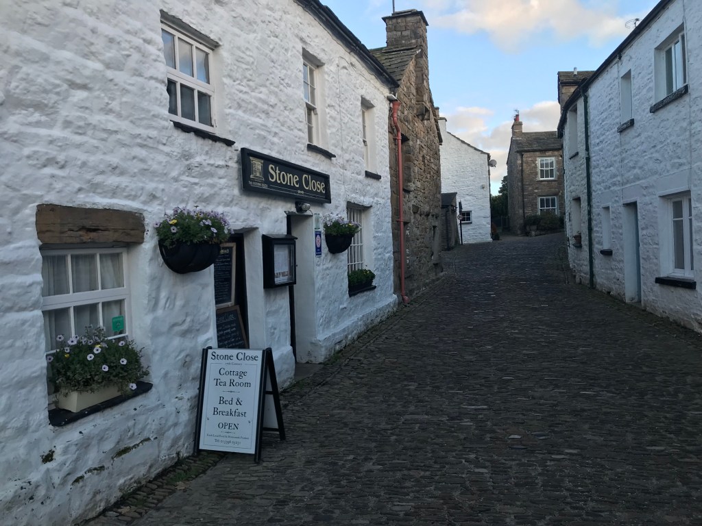

Above: The Quaintness; Below: the Heritage
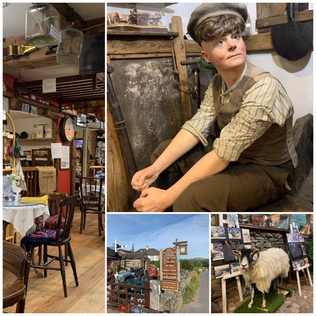
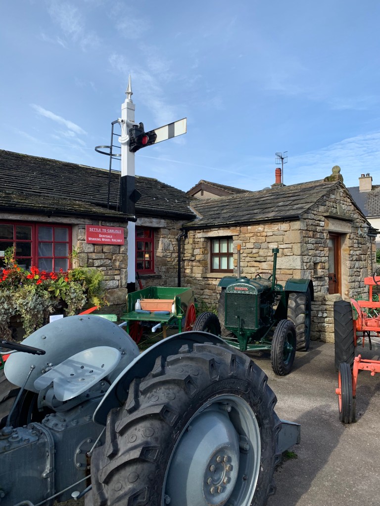
The Dent Village Heritage Centre
A surprising cornucopia of objects telling the story of life in the Dales in years gone by. A chance to see stuffed sheep and rock-chipping tools. Looms and old tractors. A place where you could appreciate the challenge of ‘living on the edge’. All in England.
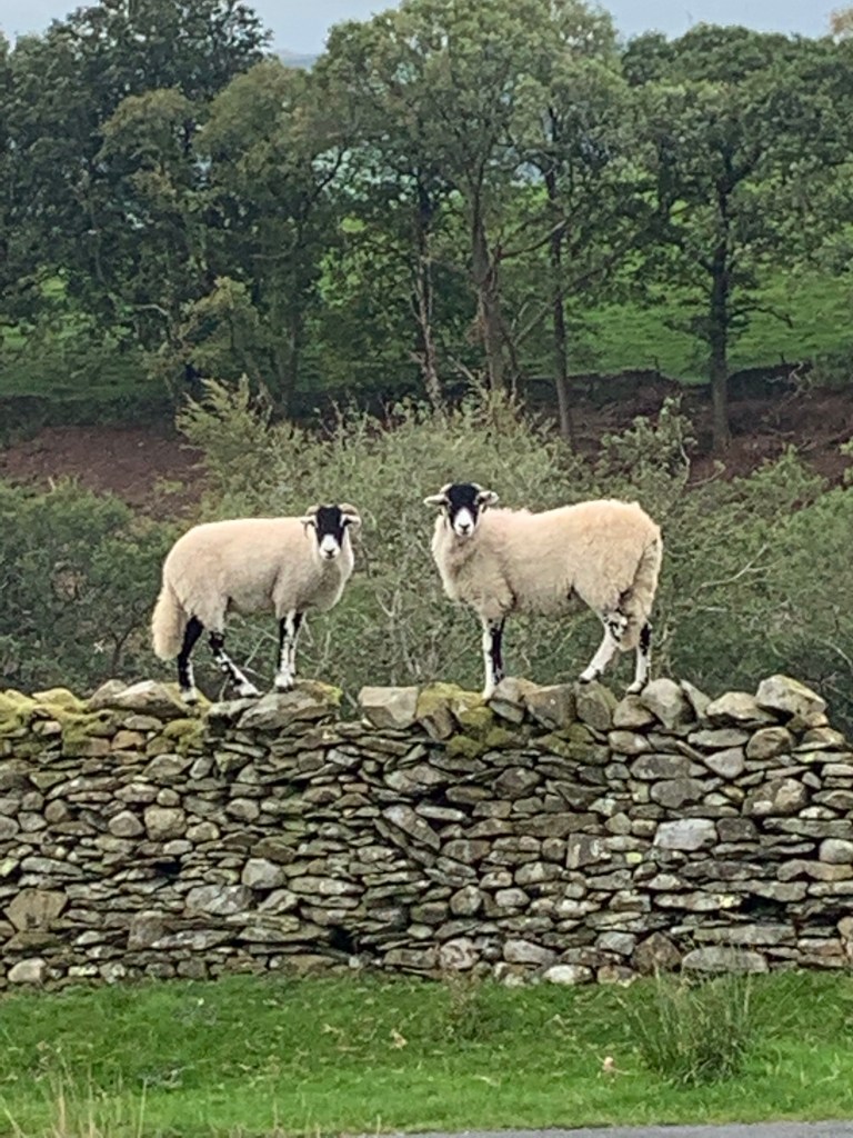
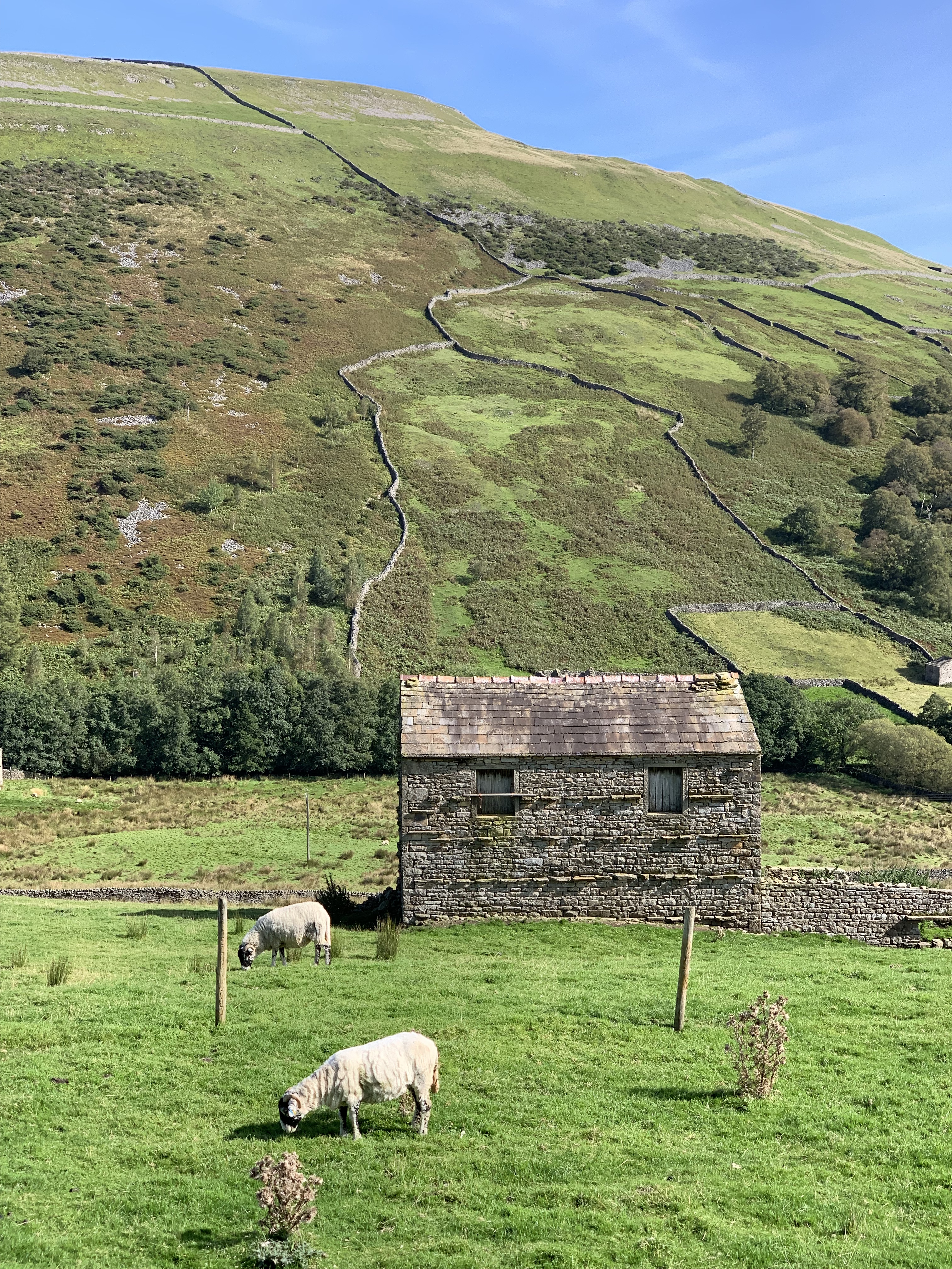
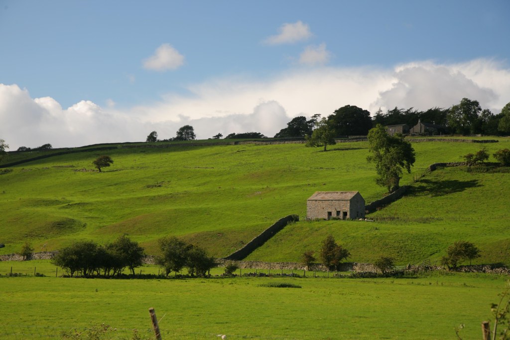
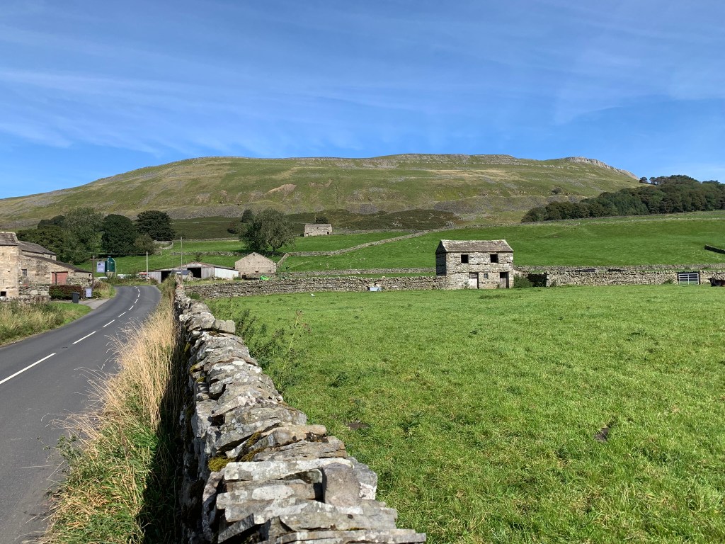
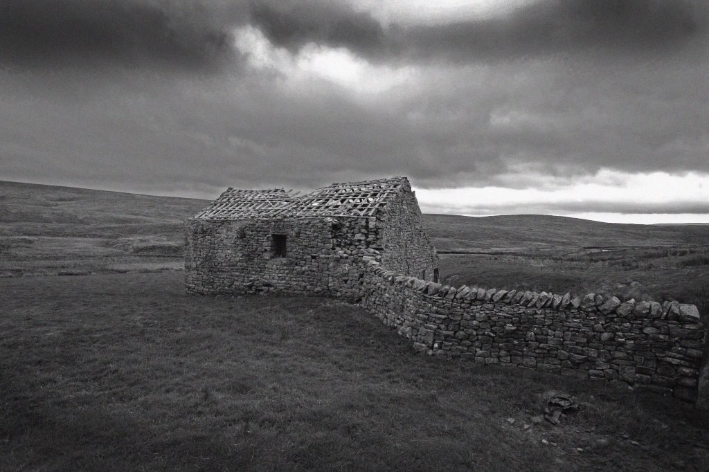
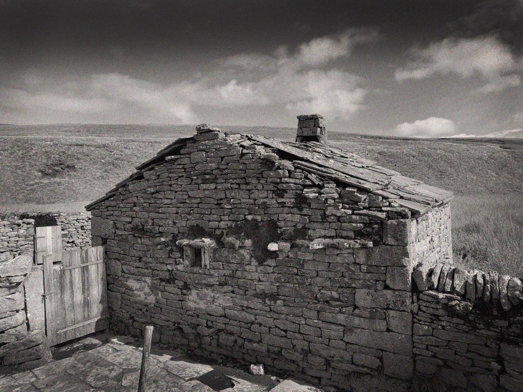
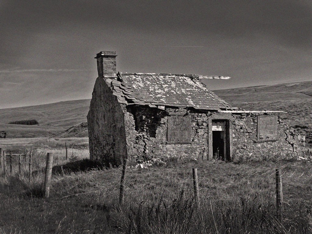
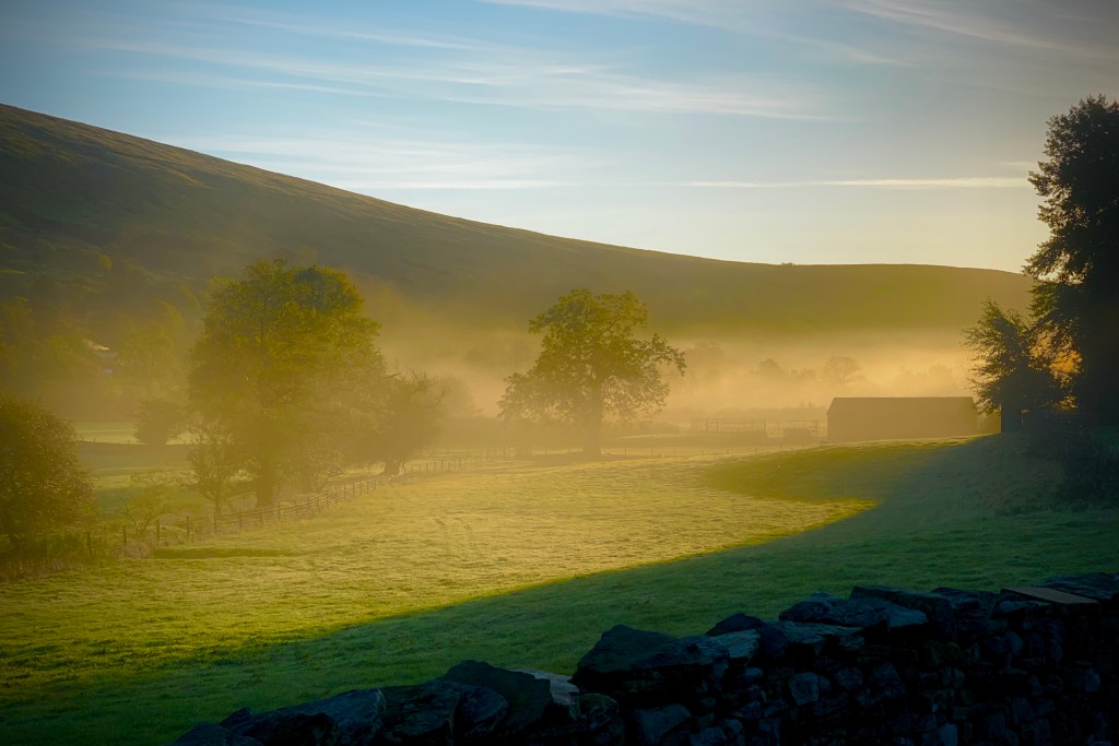
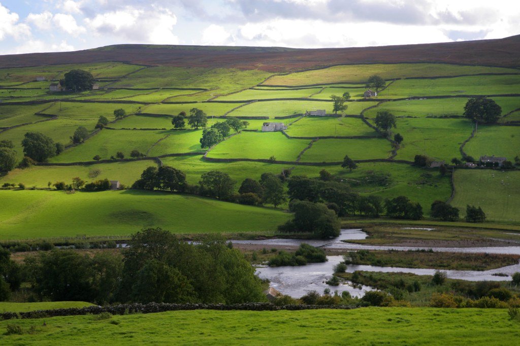
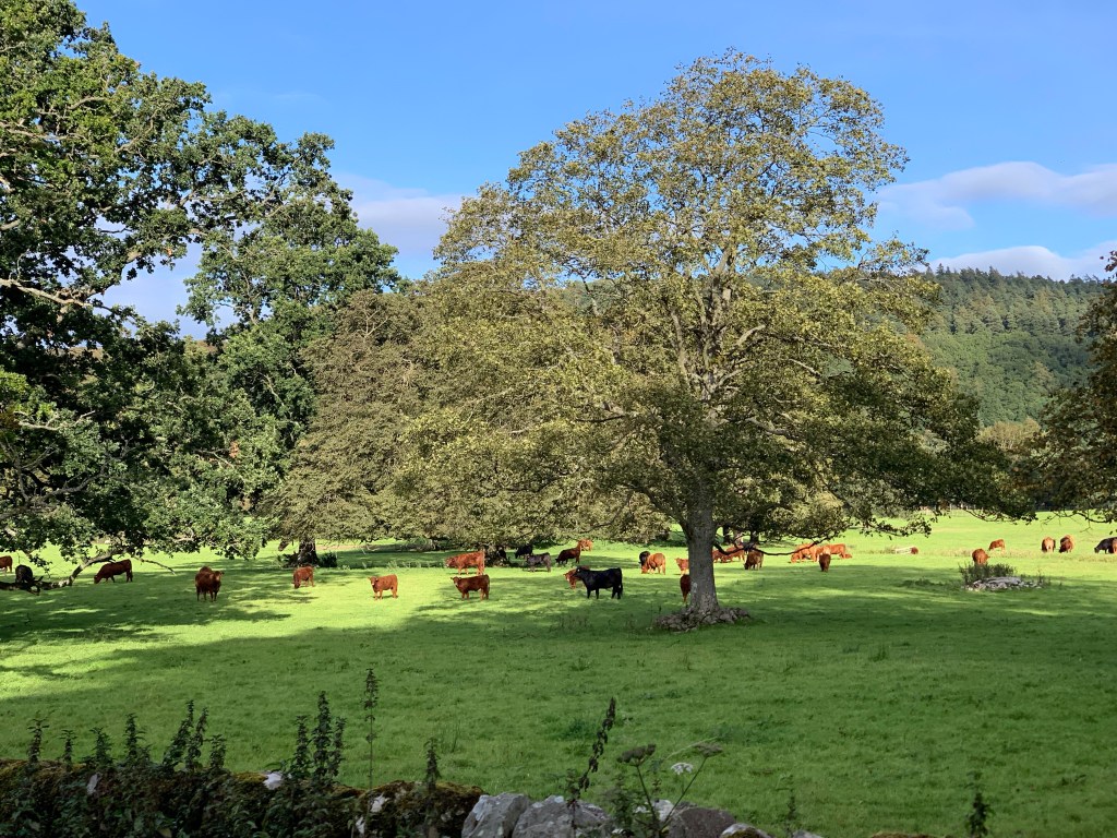
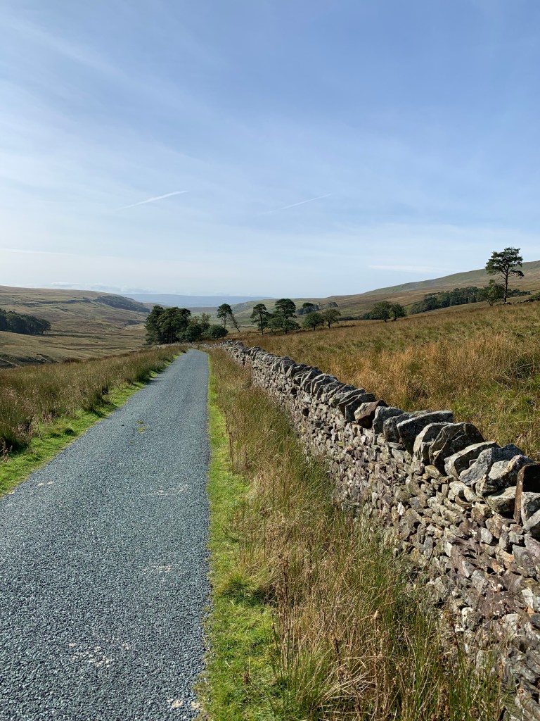
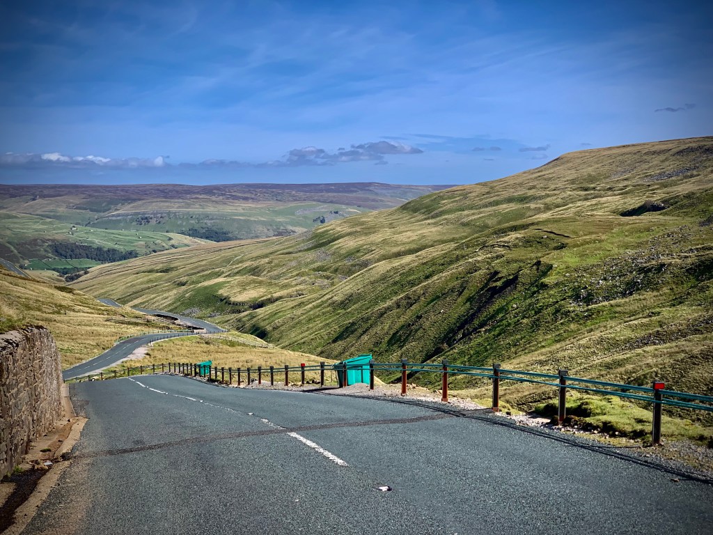
Below: Images of the Dales, and country further north in Cumbria and Northumbria. A landscape defined by its rocky outcrops and pattern-work of walls vanishing into the distance. A land dotted with old barns and sheep corrals. In places there seemed to be pride in the kempt orderliness, but elsewhere, evidence of recondite abandonment.
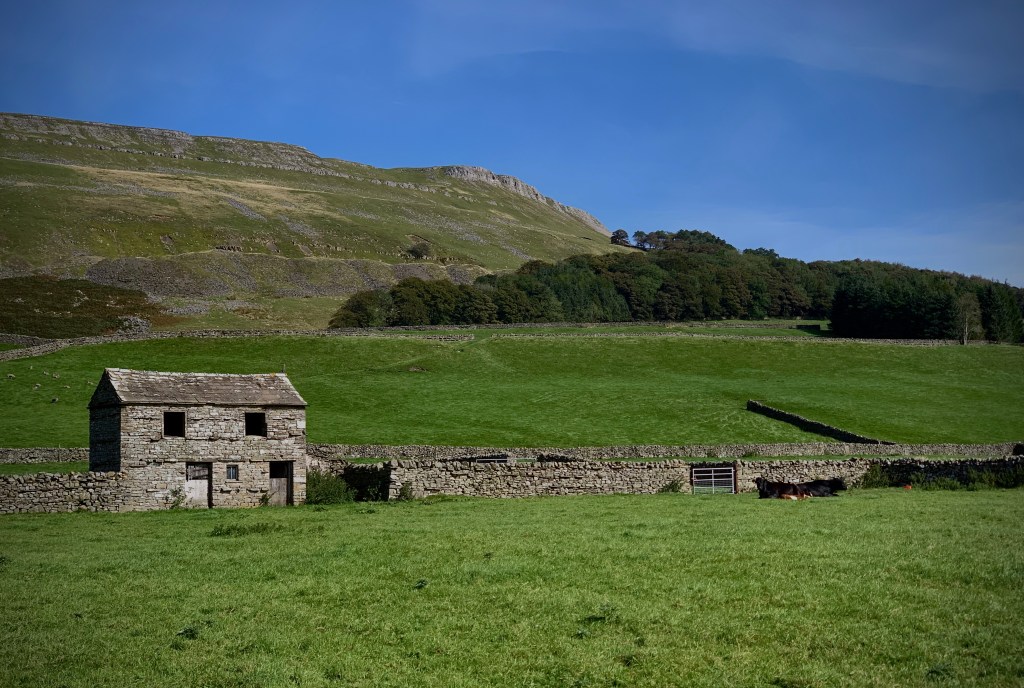
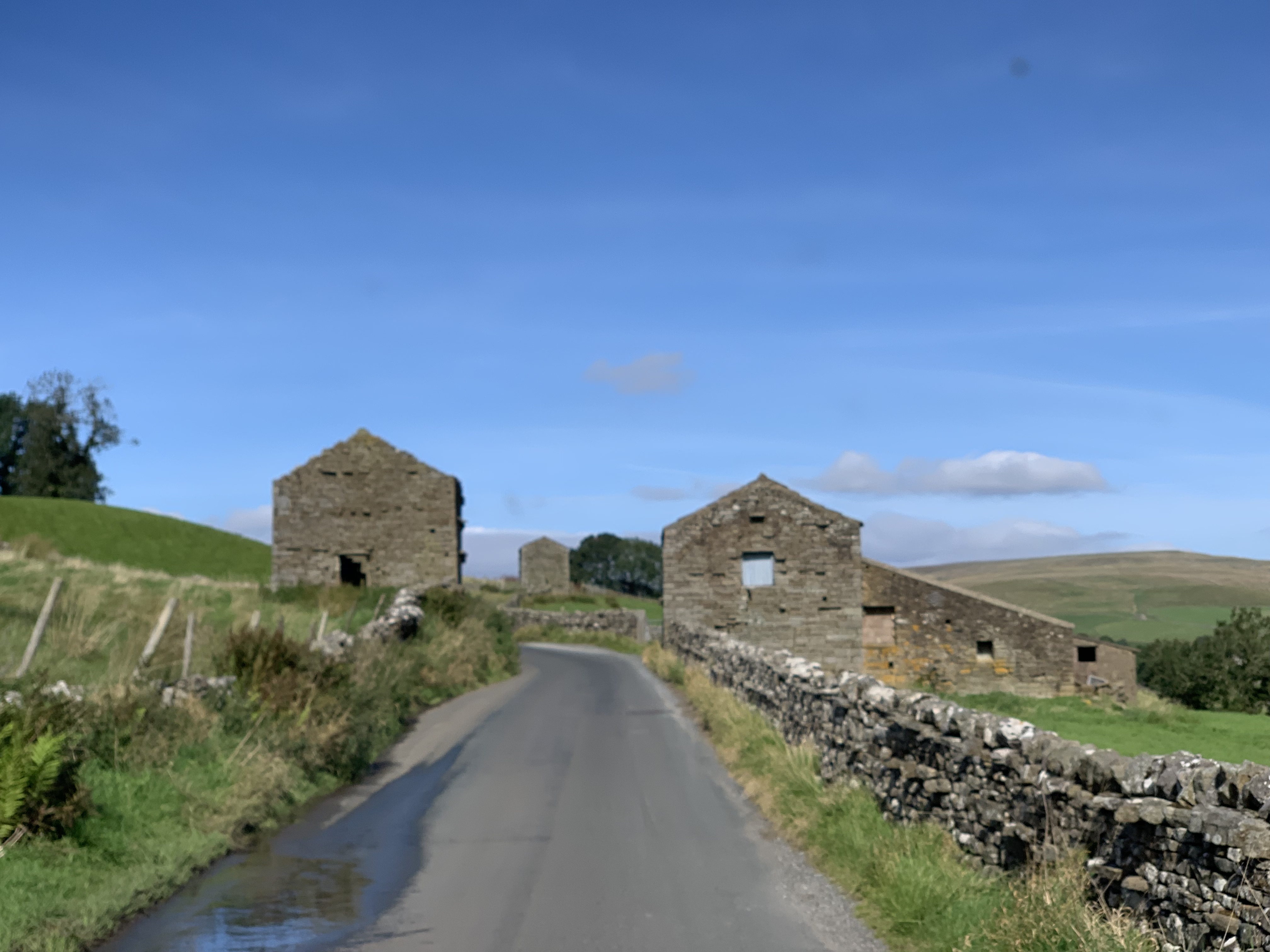


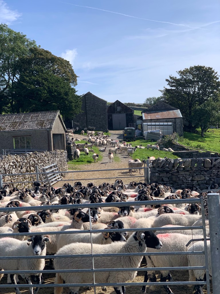

Field barns or laithes are a distinctive feature of the upland landscape. Barns were used as a combination of animal housing and fodder storage. Most are stuck out in fields and hay meadows, away from main farm buildings. Hay was stored on the first floor, ready to feed the livestock on the lower floor. Muck could then be spread on the hay meadows ready for the next crop. This saved farmers the effort of carrying hay or muck to and from the main farmstead.
Any construction in these parts featured the Throughstone. On barns and walls alike – giving the appearance of a deliberate step on the side of the structure
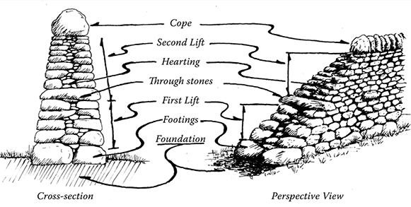
Just when you thought it was that simple, a trawl of the internet begins to show that walls are more than they seem.
In the Yorkshire Dales it is estimated that there are in excess of 6000 of these barns and over 8000 km of dry stone wall to match. Much of this I learn is desperately in need of maintenance – a task made all the harder as the ‘hands-on’ skills to achieve this are becoming few and far between.
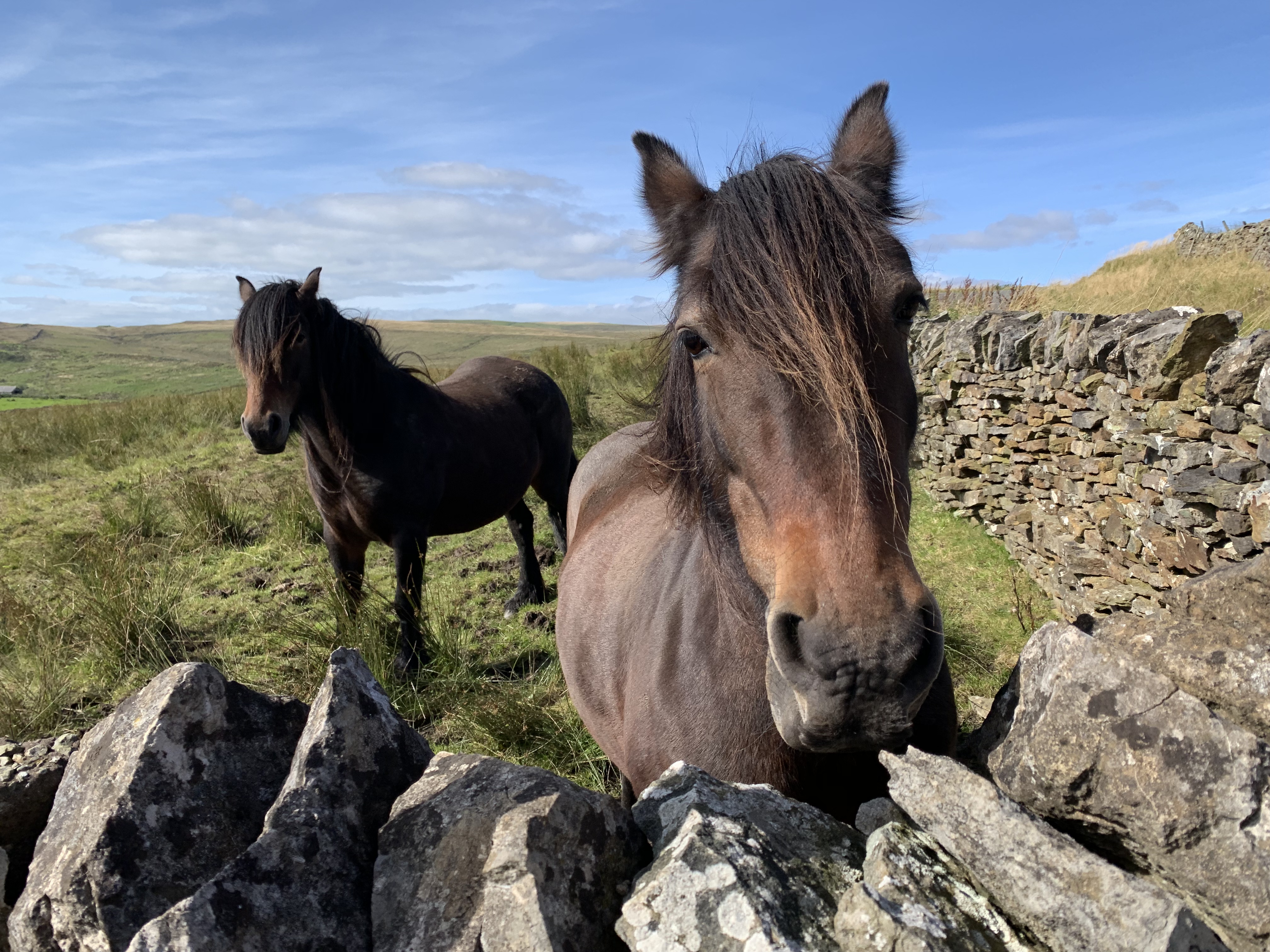
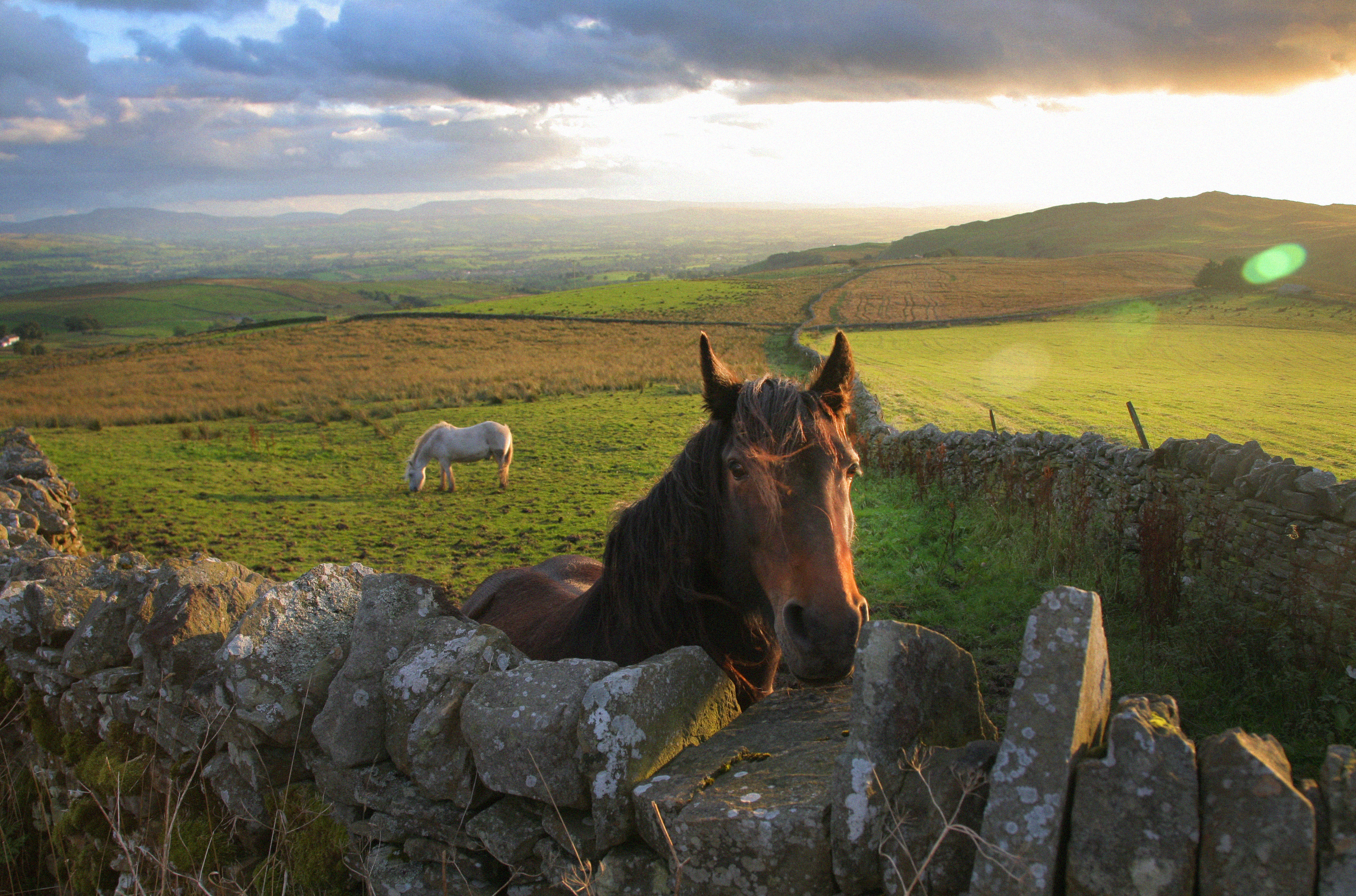
Same horse, same field. 2 years apart. Has this beast spent its life in a field defined by walls? It ran to me on a seasonal October evening in 2017, and was waiting there again in September 2019,
Guardians of the dry stone wall – these horses appear to be a permanent fixture in their exposed hillside home on the edge of the town of Alston. The above is author’s most viewed picture – the enduring horses of Swaledale. Nearly 500,000 views.
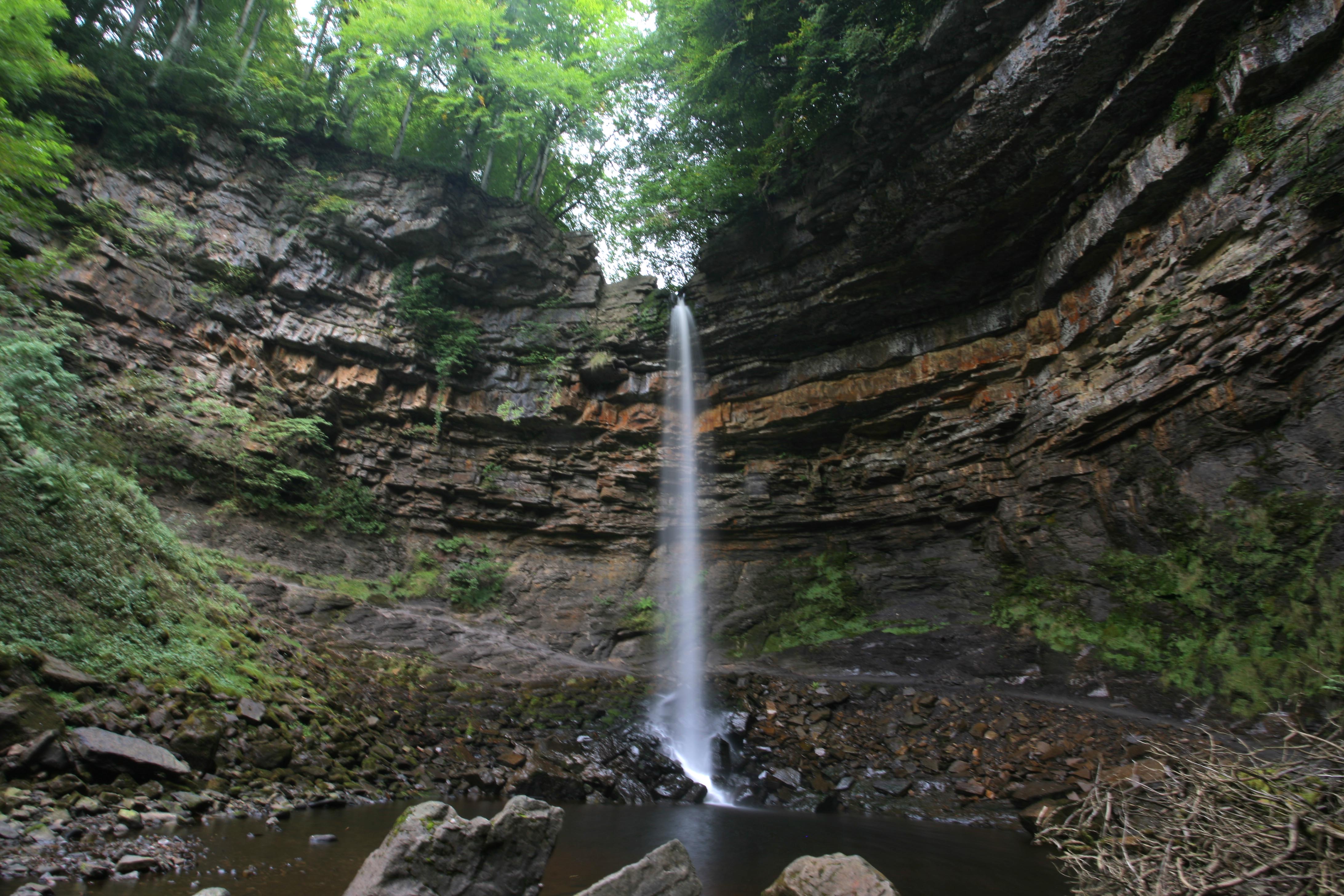
Waterfall or film location?
‘Much of the local Dales geology is limestone, and as we all remember, blah blah…’ Today’s guidebooks don’t wander into the classroom to garner interest when it’s already Hollywood-made. The region is a backdrop for film locations – all that make use of the unique scenery.
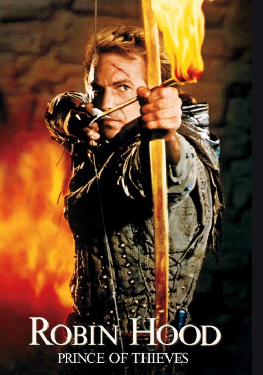
Who’d have thought that a ‘Star Wars’ was shot here? Or parts of ‘Harry Potter’, ‘Beatrix Potter’ and ‘Withnail and I?’. Postman Pat’s home is Greendale set in the heart of Cumbria, ‘Downton Abbey’ isn’t all in Oxfordshire; Locations have been found for ‘Brideshead Revisited’, ‘Billy Elliot’, ‘Elizabeth I’ and of course ‘Robin Hood’.
Below: Hardraw Force, England’s highest waterfall, but probably almost as well known for Robin Hood using it as a shower in 1991.

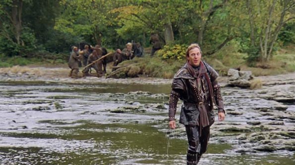
In the same film Robin confronts Little John on the steps of the Aysgarth waterfall [below] – when there was less water than during my visit

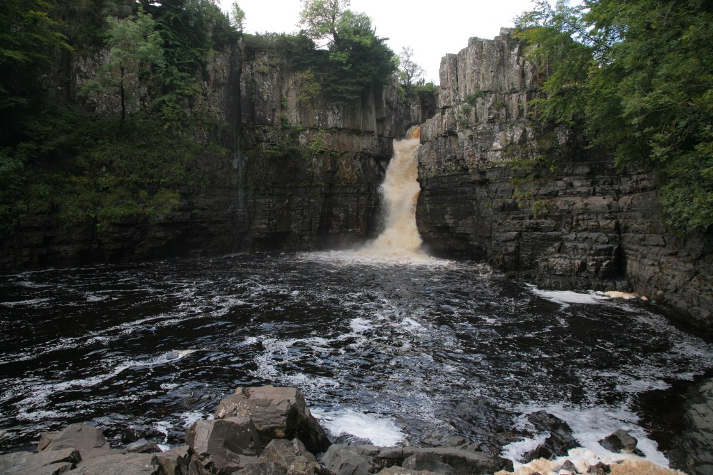
Above: The High Force Falls at Middleton. A short drop for the river Tees before it makes its way out to sea via the industrial areas of the North East. The word ‘Force’ is in widespread use in this part of the world. Literally meaning ‘Falls’, and is a derivation of the old Norse word ‘Foss’.
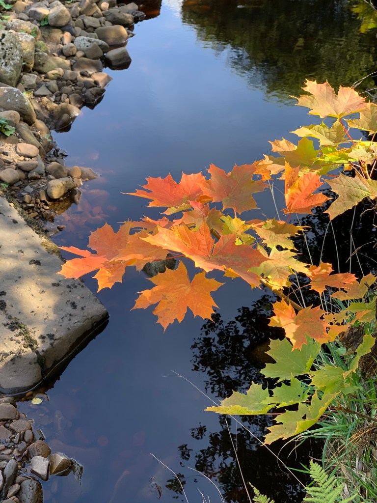
Below: More Force, this time showing Autumn Gold at a place called Muker.

Onwards North as the Romans did nearly 2000 years ago

A rainbow means luck?
The Wall

At the time of writing, the incumbent US president is fighting his campaign for re-election based largely around the country’s economy and of course his capable handling of the Covid pandemic. The infamous wall above is a reminder of one of President Trump’s ‘brainchildren’ during his thus-far presidential tenure. A barricade to keep those nasty Mexicans out of the US of A. Controversial or comical it may be, walls throughout history have definitely made their presence known.

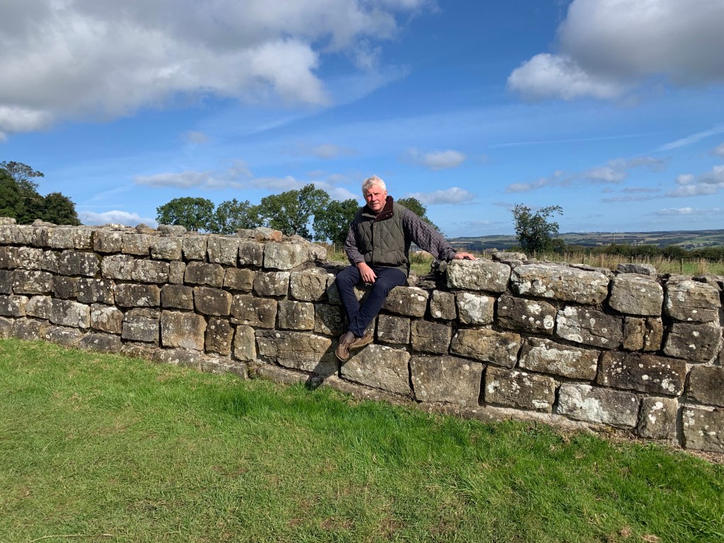
The author sitting on 1900 year old block-work, which in close-up still displays the craftmanship of its makers long after they had left this remote outpost. The spirits of of the Roman legions may still blow on the wind, but the moment they left, Northern Britain became once more a dangerous and lawless land. The Dark Ages had begun and Britain had a 500 year winter to endure.
Some walls were built better than others – some are older. Hadrian’s is definitely a good example of both.

Known as the Sycamore Gap, a few miles from the old fort of Vindolanda, and the Housesteads Garrison, this is one of the iconic views of Hadrian’s Wall and you’ve guessed it – a well used film location.
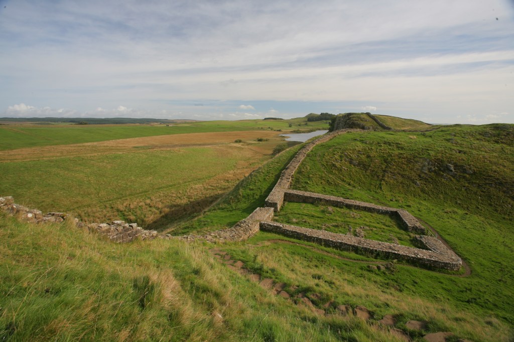

Above: A Milecastle, literally a garrison fort that would have been one of almost 70 found at regular mile intervals along the length of Hadrian’s Wall.
Europeans today may find the concept of miles, yards and feet a tad illogical – by metric rules; but it’s worth remembering that one of the Roman legacies was this system of measurement, a mile was a thousand [large] paces – mille, and a foot, piede, was the 12 inch thing at the end of your leg.
What remains of the Roman occupation around the north of England is still, in many places, being unearthed. Indeed the modern road-workings near the Wall at Haltwhistle make daily finds as a new visitor centre is being built. Further East along the A69 trunk road you come to the village of Haydon Bridge which now straddles the southern fork of the river Tyne. 1900 years ago this place was clearly considered important by the Romans as a viable crossing point just outside the bigger town of Hexham.
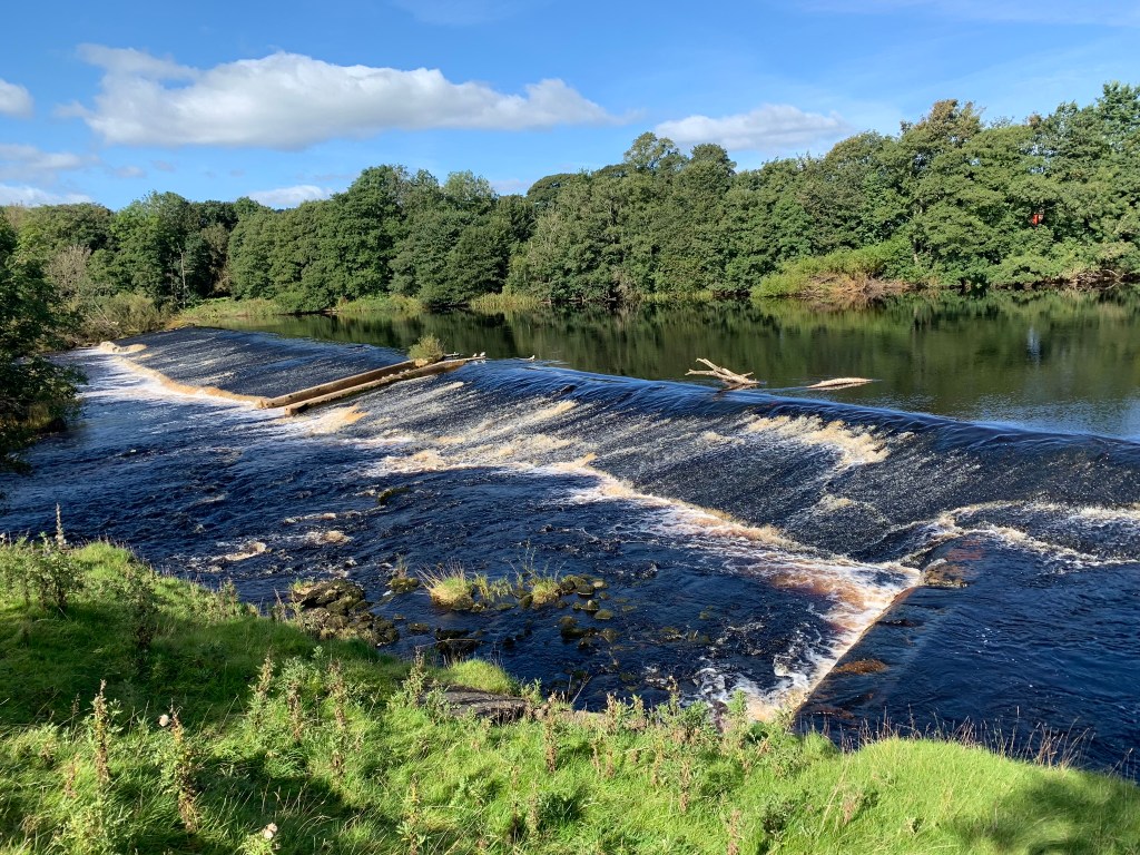
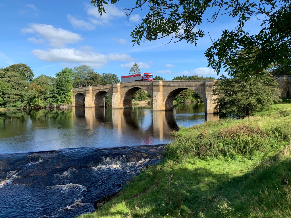
And a grand crossing point it is – not just to the casual passer by, but also to major transport and busy commuters. What’s remarkable is that some of the foundations of the bridge that gives the village its name are from the Roma era. Although much of the ‘modern’ part of the bridge [13th Century] is built with masonry robbed from the nearby Roman Wall, it’s a powerful sight to watch modern transport crossing a bridge held up by foundations made all those years ago. There must be ghosts of the people who were enslaved here to work on this construction. Ghosts that rise and fall with the comings and goings of the ‘Fog on the Tyne’.
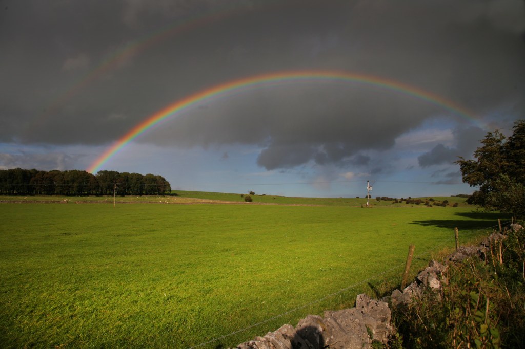
A lucky sign for the superstitious? Afternoon light spills across Dale Country and its age-old walls.

Amazing blog!
LikeLike